Hobson Creek Watershed History - The 1800's
Before the 1800's when the land was formally purchased for the first time, the picture of the Hobson Creek watershed and the land that surrounds it remains unclear. Likely this watershed was used to some extent by the Native American people who also utilized the nearby Russian River and all of its resources. As research is done, hopefully more of the story unfolds.
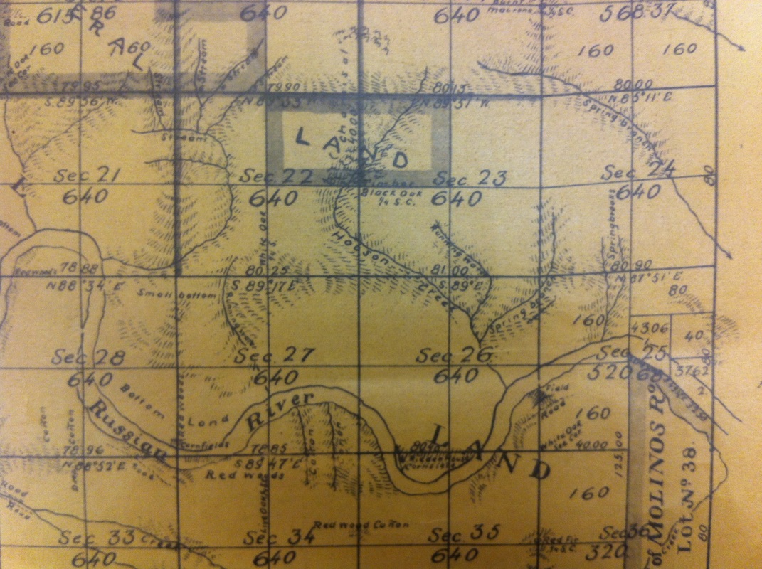
The Survey Map below is dated 1866. It doesn't include property owner names although a lot of this land had certainly already been purchased from the government. The creek was already named Hobson in 1866. The two main branches are labeled as Spring Branch and Running Water. All of the unnamed water features in the surrounding area have the same generic labels and to this day, although they tend to run year around, the branches remain unnamed. This 1866 survey map includes the locations of various timber resources: Redwoods, White Oaks, Black Oaks, Madrones, and Live Oaks. Bottom Land and some small patches labeled Corn Fields are shown down by the river's banks.
The Survey Map below is dated 1866. It doesn't include property owner names although a lot of this land had certainly already been purchased from the government. The creek was already named Hobson in 1866. The two main branches are labeled as Spring Branch and Running Water. All of the unnamed water features in the surrounding area have the same generic labels and to this day, although they tend to run year around, the branches remain unnamed. This 1866 survey map includes the locations of various timber resources: Redwoods, White Oaks, Black Oaks, Madrones, and Live Oaks. Bottom Land and some small patches labeled Corn Fields are shown down by the river's banks.

1866 Sonoma County Survey Map
In the mid 1860's the area's schoolhouse was located nearby. In 1867 it was located on the McPeak's original property, but either moved or the property was sold so that it was finally located on what was then the Ridenhour property, adjacent to the Hobson Creek watershed. Today, we know its location because it became known at Schoolhouse Canyon Campground. The Ridenhour school appears on many of the future maps of the areas and

|

|
In 1871, Anthony McPeak, a young man originally from Missouri, bought almost 700-acres of the watershed with the money he received from the sale of his previous property to the Korbel brothers just downriver. On this new, huge, property Anthony set to work clearing and prepping the land to be cultivated just as he had done at the Korbel's.
The land that the McPeak family purchased had some river frontage but mostly consisted of the Hobson Creek watershed and surrounding forested land. It is unclear at this time whether the land had been improved at all at the time of McPeak's purchase. Judging by the 1866 survey map, at that time, it was mostly Redwood Timber, with a small road and fence also noted.
The land that the McPeak family purchased had some river frontage but mostly consisted of the Hobson Creek watershed and surrounding forested land. It is unclear at this time whether the land had been improved at all at the time of McPeak's purchase. Judging by the 1866 survey map, at that time, it was mostly Redwood Timber, with a small road and fence also noted.
1874 Sonoma County Survey Map
In 1874, three years after the McPeak's purchased the land, another survey map was created. This one was slightly more detailed and many of the same natural resources are labeled. The section so prominently labeled Redwood Timber across the Hobson Creek watershed is now missing and it's unknown whether that is intentional and due to logging, or if the information was simply omitted. Eight years after the original, corn is still being grown along the river just west of the watershed.

1877 Thompson Atlas Map - the whole Forestville / Hacienda area was known as Redwood Township
|
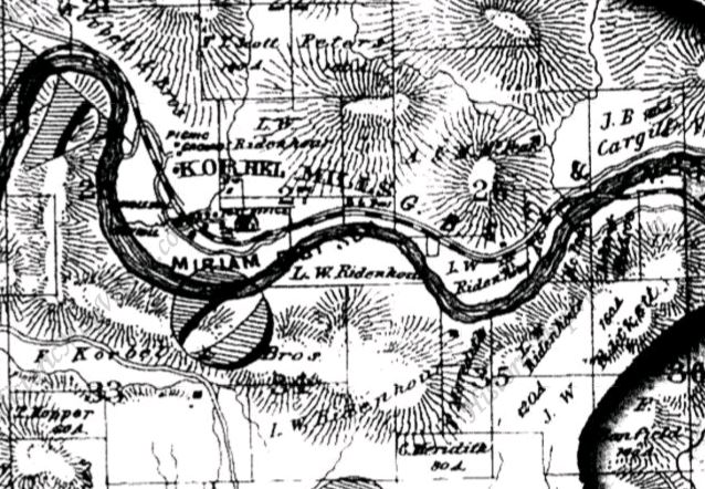
1877 Area Map, depicting the Hacienda area including the Ridenhour and Korbel neighbors.
|
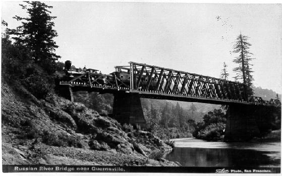 The original Hacienda Bridge - this photo dated 1888
The 1877 maps show us the property owners' names and property lines. On most parcels the acreage is not listed, which is rare for these types of maps. What we can see, however, is that the old River Road is now running along the River, along with the black and white dashed railroad line, that runs into West County and literally through the McPeak property. A smaller parcel of land owned by the McPeaks (located southeast of their larger parcel) spans the River and the location of the current Hacienda Bridge. The bridge also existed at that time, and carried trains.
Indeed, today there are homes off Sequoia and Dell Roads that are constructed of the old railroad cars, left behind when the railroad was taken out.
Indeed, today there are homes off Sequoia and Dell Roads that are constructed of the old railroad cars, left behind when the railroad was taken out.
The McPeak Family owned a large and diverse piece of land and immediately began trying various methods and products to see what would be successful. Early on, Mr. McPeak ran nearly 800 head of sheep on his land. He was one of the first and only landowners to own sheep in the area. Crops that were grown in and around the watershed and along the river are quite unexpected, such as the sun-loving corn shown growing along the River since the 1860's.
In 1877, nearby farms were growing good quality tobacco
|
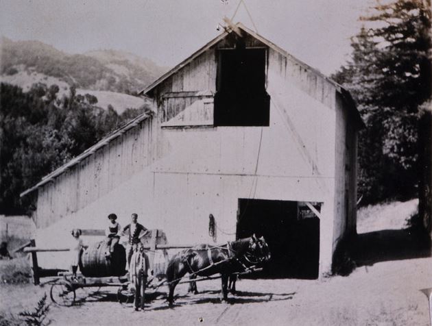
The McPeaks grew hops and were known for the beer they brewed at this barn.
|
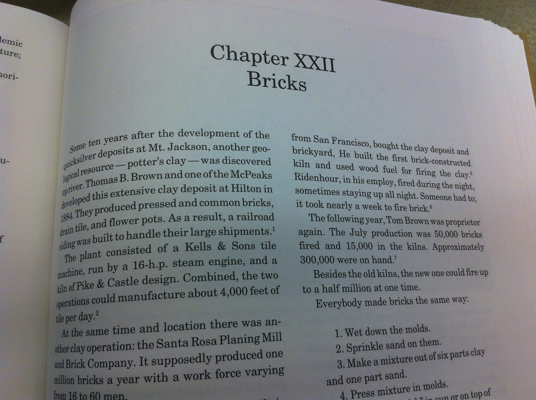
The discovery of good clay deposits got the McPeaks in the brick-making business
|
By the late 1800's, every ten years the U.S. government performed an agricultural census along with a population census. At that time, many American families still lived on and worked farms. These documents show us exactly how many acres of a farm were worked, how many crops they yielded and even how many animals were raised on the land. This is a screen shot of the 1880 Agricultural Census that shows the McPeak's and all their surrounding neighbors' farms.
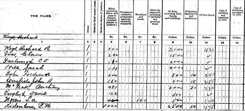
This is the Agricultural Census for 1880. It lists all the animals and plants raised on the farms of the watershed.
Mercury mines were located just north of our watershed. Surrounding those mines were mining towns, that seemed to appear over night. On the McPeak's own land, and located northwest of Hobson Creek were "Indian Mineral Springs" that the McPeak's advertised into the 1900's. Where are these springs today? How has all the logging, farming and industry changed the land and watershed we see today? Is our land/water affected today? How old are the old fruit trees we find hidden among our native trees? Who planted them?
Although the landscape was much changed from its original pristine redwood forests, one can imagine a diversity of crops and animals being raised along the river. Life along the river was not what we see today in Sonoma County, with its manicured rows of vineyards for as far as the eye can see. History shows that back then, landowners were experimenting with just about anything they could get to grow. Each landowner tried to make his/her own way by finding out the best crops and animals to raise and it inevitably had a huge impact on the landscape and environment.
Although the landscape was much changed from its original pristine redwood forests, one can imagine a diversity of crops and animals being raised along the river. Life along the river was not what we see today in Sonoma County, with its manicured rows of vineyards for as far as the eye can see. History shows that back then, landowners were experimenting with just about anything they could get to grow. Each landowner tried to make his/her own way by finding out the best crops and animals to raise and it inevitably had a huge impact on the landscape and environment.

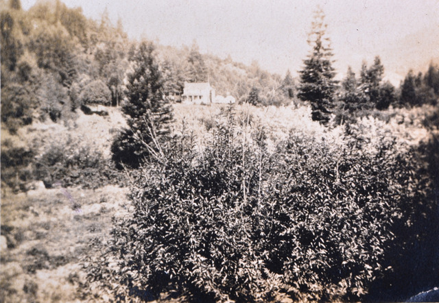
View from the McPeak's porch - look at the amount of sun and cleared space
|
McPeak Property: Look at the size of the trees? where are the giant redwoods?
|
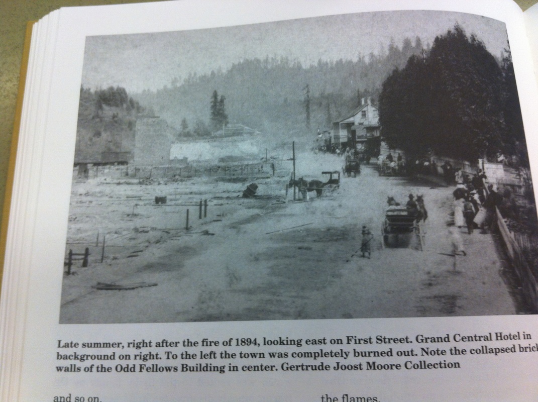
In 1894, the town of Guerneville was devastated by fire
During the 1894 fire, a large portion of nearby Guerneville was destroyed. Several town residents died in the fire including the local doctor. Dr. Burns' death was an enormous loss to the community. The McPeak men were pallbearers at the beloved doctor's funeral.
|

Area map of Hacienda and our watershed, dated 1898. The McPeak land was then 492+ acres and the house is marked on the map
|
